Single line 6 miles
Opened 9.8.1884 West Drayton - Colnbrook; 2.11.1885 Colnbrook
- Staines West.
Closed to passengers - 29.3.1965
Closed to goods - 27.1.1981 Colnbrook - Staines West New Spur
Jn.
Stations
- West Drayton 2nd (opened 1884) r/n 1895 West Drayton &
Yiewesley r/n 1974 West Drayton; West Drayton 1st (opened 1838,
closed 1884)
- Colnbrook Estate Halt
(opened 1961, closed 1965)
- Colnbrook
(opened 1954)
- Poyle Estate Halt
(opened 1954)
- Poyle Halt
for Stanwell Moor (opened 1927)
- Runnymede Range Halt (opened 1887) r/n 1934 Runymede Halt r/n
1935 Yeoveny Halt (closed 1962)
- Staines r/n 1949 Staines West.
Motive Power Depots - Staines one-track sub-shed to Southall
81C (closed 1952)
History
The town of Staines, 19 miles SW of central London, was in
Middlesex until 1974 but is now in Surrey close to the Gtr London
boundary. Independently promoted the Staines & West Drayton
Railway (S&WDR) it reached Staines in 1885 and was absorbed
by the GWR in 1900. The original plans had envisaged linking
it into the Windsor lines on Staines Moor but the L&SWR would
not agree so it was carried over its lines to terminate alongside
Pound Mill in Moor Lane. Because finances were tight the struggling
S&WDR bought a mill owner's house adjacent to the site and
altered it to serve as a station. In 1964 the Western Region
provided 14 trains on weekdays the journey with four stops taking
17 mins; the following year the service was withdrawn.
After closure to passengers the goods
yard at Staines West was demolished and a rail accessed oil storage
depot built in its place. When the line was severed by the building
of the M25 in 1981, a new connection with the Southern Region
line was made to serve the oil depot but ten years later it closed.
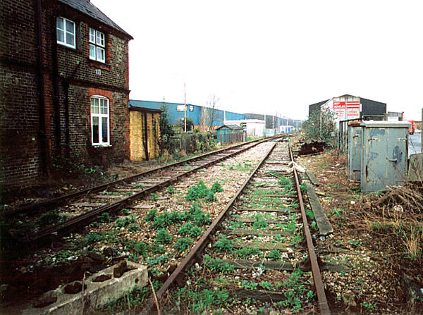
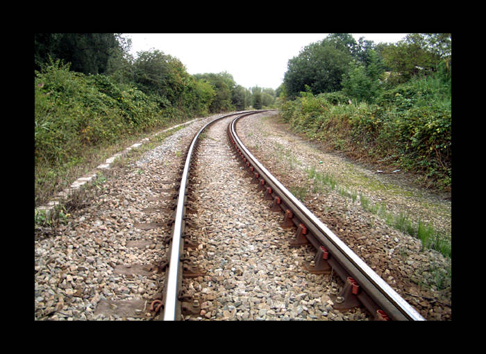
The three miles between West Drayton and Colnbrook remain open
as a means of getting stone, steel and construction materials
to Heathrow Airport for the terminal 5 project due for completion
in 2008.
Route - when open
The bay platform at the west end of West Drayton station
(GR061801) was used by both Uxbridge and Staines branch trains
with both branches diverging NW from the Paddington - Reading
line immediately west of the station. The two branches then parted
company after a short distance with this line turning south to
pass under the main line and bridge the River Colne. From there
it headed SW passing under the later M4, the A4 at Colnbrook
Estate Halt and at Colnbrook over Bath Road by means of a level
crossing. Poyle for Stanwell Moor Halt was located on the south
side of the Horton Road overbridge and for the next two miles
it ran south alongside the Wraysbury River. It then climbed away
from Yeoveney, bridged the L&SW Windsor branch, passed under
the Staines Bypass (A30) and ended at Staines West station (GR032718)
near the junction of Wraysbury Road and Moor Lane.
Route - today
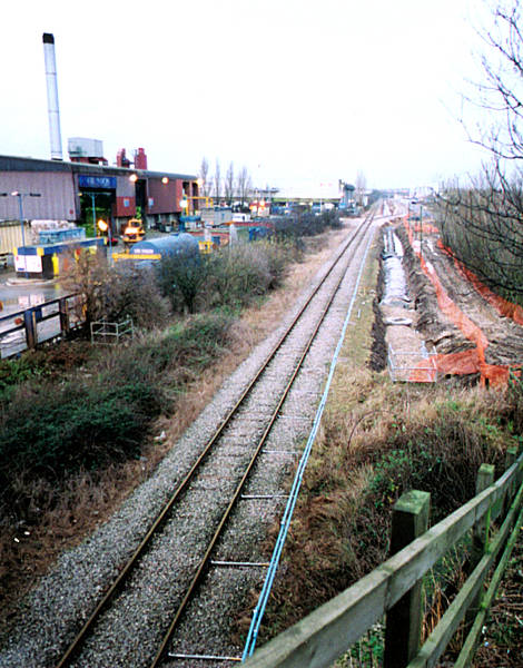
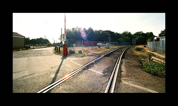
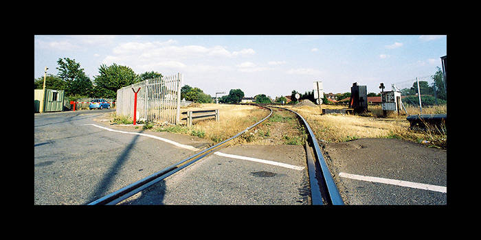
The operational part of the branch currently ends at the
site of Colnbrook station (GR036767) in Bath Road and since April
2004 rails across the Bath Road have disappeared under a thick
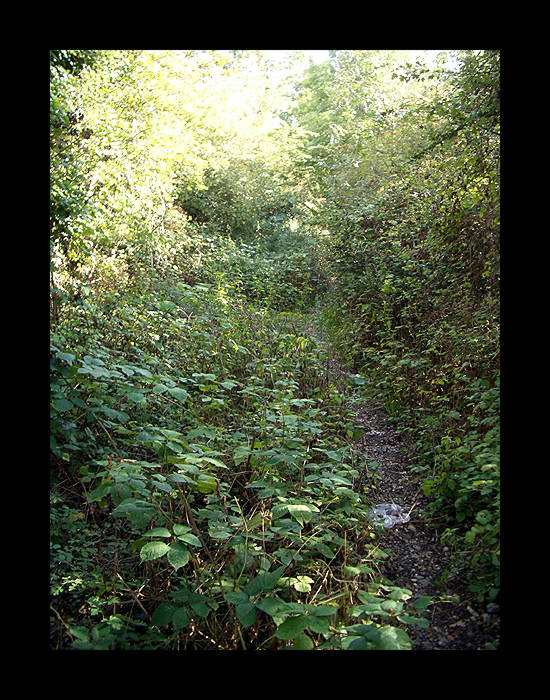
layer of tar. From there it is walkable south to Horton Road
where, in 2003, there was a work site for an M25 spur. The trackbed
continues on the opposite side of Horton Road and ends abruptly
at the M25. For 320 yards, the trackbed is lost under the M25 but a pedestrian underpass under J14 gives access
to a tarmac bridleway that the route of the line joins. The trackbed stops at the dismantled bridge over
the existing LSWR line. A pedestrian crossing over the line slightly
further west leads to Moor Lane which leads to Staines West station.
Overgrown tracks that served the oil depot at Staines are still
in place.
Relics
- West Drayton station (2nd) - still open (Paddington - Reading
line)
- West Drayton station (1st) - demolished: no trace
- Colnbrook Estate Halt
- no trace
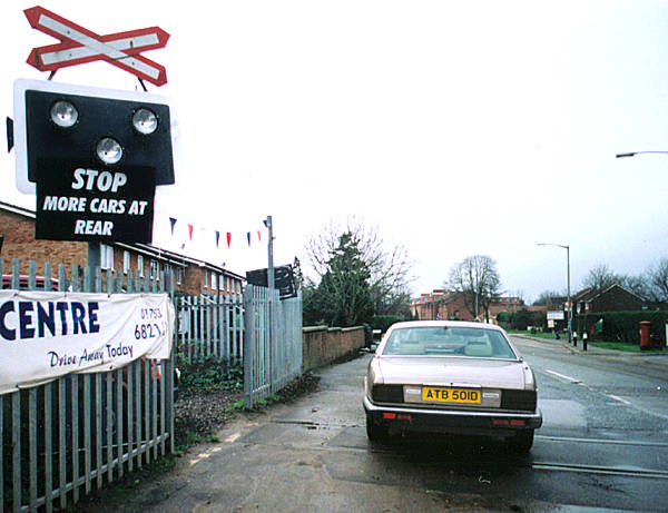
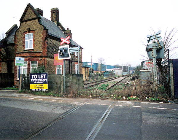
- Colnbrook
platforms and main station buildings removed but S.M.s house
alongside the level crossing survives
- Poyle Estate Halt
- no trace
- Poyle Halt
for Stanwell Moor - built over by J14 of M25
- Yeoveney - Wooden entrance gate and concrete supports remain.
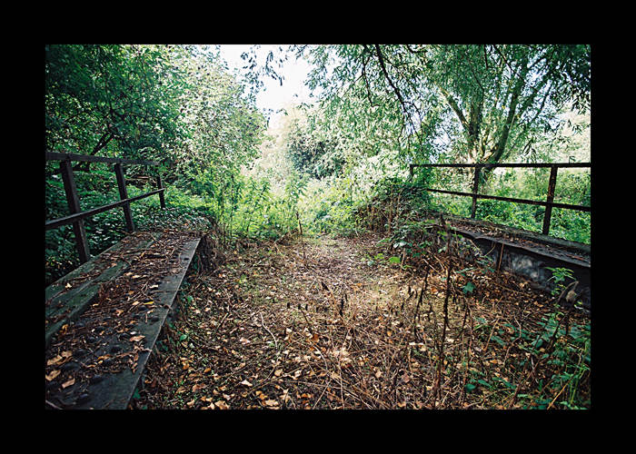
- Staines West
station building intact listed grade ll, a section of platform
track and buffer stop remain, platform area now a car park.
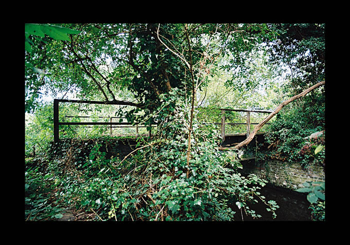
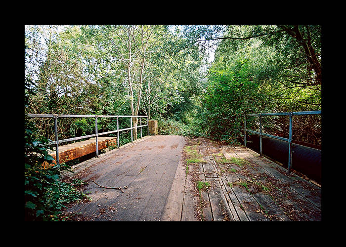
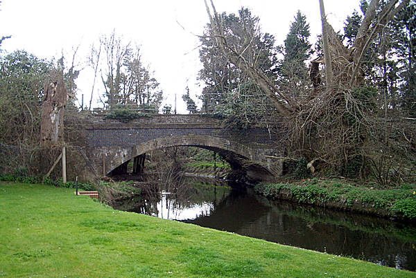
Bridges - all bridges in place West Drayton - Colnbrook
bridge over stream south of Colnbrook station in place
bridge over stream north of Horton Road in place but heavily
overgrown
Lintel's bridge carrying Horton Road at Poyle Halt for Stanwell
Moor demolished and built over by J14 of M25
bridge over Windsor Branch at Staines - bridge removed but both abutments remain
brick-arched bridge over Wraysbury River in Staines demolished
underpass under A30 in Staines survives with impenetrable undergrowth
on north side
cattle bridge over line south of A30 in place.
Loco sheds - Staines (GR033720) on west side of line at north
end of Staines West station demolished 1955, site now a timber
yard.
(The above text courtesy of Ralph Rawlinson ©2005.)