MILL HILL EAST - EDGWARE


This was a single track line. The pre-war plans were to double track it and extend it northwards from Edgware (LT) station. Although significant work was completed, post-war Green Belt legislation meant that housing development wouldn't be permitted on the section north of Edgware*, so in common with the Finsbury Park - Highgate branch, it was abandoned.

*Brockley Hill would have actually still been within the Green Belt boundary. Bushey Heath would have been outside it.


Mill Hill East station looking south/east. Clearly visible on the right is the space left by the removal of the extra track created for the expansion program. This station now provides a curious appendix for the Northern Line north of Finchley Central, yet the original plans for this branch (to Edgware and Bushey Heath) would have seen it being the main branch, with High Barnet being the lesser one.


Looking in the Mill Hill direction. The block of flats visible past the end of the tracks are on the route of the line. The bridge to the left of the flats looks level with them but is in fact behind them (the line swings left). The overhead cable bridge seen here no longer exists.

Trains reach this station from Finchley Central via the architecturally magnificent Dollis Brook viaduct. One can't help but wonder what would happen if the viaduct needed expensive repairs - would London Underground propose closing the Mill Hill East branch for not being financially viable (as they did with the Aldwych branch)?


A few hundred yards west of Mill Hill East station is this bridge carrying Sanders Lane over the top.

This is the bridge visible in the above photograph.


The other side of the bridge looking looking like it is need of urgent repair: the bricks on the supporting arch are falling off and there is a large crack on the underside of the arch.

(photo: Mar 2014)


It is surprising just how long some abandoned railway lines hang on for in London. They are after all a source of prime land - albeit with no rail access!

This is the bridge carrying the extended section of Devonshire Road (it was formally the western section of Sanders Lane. Before its truncation, it crossed the line twice).


The underside of the Devonshire Road bridge, showing the original bridge and its extension for the increased traffic that the road now carries.

(photo: Mar 2014)


Concrete cable posts installed but never used, still in situ in Feb 2008.


Concrete cable posts installed but never used, still in situ in Feb 2008.


Anti- bike/horse devices (delete as appropriate).

(photo: Feb 2008)


All that remains of the line passing underneath Page Lane.
I'm sure he does.

(photo: Feb 2008)


The route of the line as it passes beneath the A41. This particular section was used as the M1 slip road to the A41 until the Staples Corner M1 extension was opened (and was reopened temporarily when Staples Corner was closed for rebuilding after a terrorist bomb explosion).

(photo: Nov 2005)


Running parallel with Bunns Lane, this is one of the few sections of track still extant, though probably not for much longer.
This view is south-easterly, looking back toward the Mill Hill East direction.

(photo: Apr 2014)


Looking in a north-westerly direction: the road in the foreground is the new alignment for Bunns Lane, built on top of the infilled line, on the eastern side of where the M1 motorway is now. The former route of Bunns Lane was carried over the railway by the bridge pictured. The bridge has now been demolished and the area is occupied by an industrial works.

For a photo of the same location in Feb 2008, move your cursor over the image.


The site of Mill Hill (The Hale) station was located between the bridge carrying the mainline from St.Pancras and the bridge carrying the western end of Bunns Lane (now on the west side of the M1 motorway). The site was largely covered over with spoil taken from a slip road constructed for the M1.

The station originally only had a single track and (wooden) platform but it was given a concrete extension and a new second platform, just before the outbreak of World War II. The extra track was lifted a couple of years later however and the station never saw passenger service again.

The small piece of platform seen here was located under and to the west of the Bunns Lane bridge. Of the three bridge arches, this was the southern one.

The arches to this bridge have now been bricked up.

Photo by Andrew Panatti. ©2006


The view from the Bunns Road bridge middle arch looking toward the Edgware direction.


The remains of the 'new' northbound platform looking north-west. This platform did not see passenger service.

(photo: Oct 2013)


The remains of the 'new' northbound platform, looking north-west, taken from a track position.

(photo: Oct 2013)


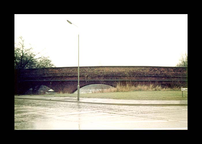
Further along the line, this is the bridge that took the original GNR track route to its Edgware station, over the Northern Line's Edgware branch tracks. The London Underground's Edgware station is to the right.

The bridge still exists, in somewhat altered form, as part of a pedestrian route for London Underground staff.


The original GNR station at Edgware was used as a goods station until the line's metals were removed in 1964. Its site is now occupied by the Broadwalk shopping centre, a tower block and other buildings.

There is however, this very small section of the track route remaining at the end of the shopping centre car park.

(photo: Feb 2005)


The original GNR station at Edgware as seen in this 1948 aerial shot from the marvellous and highly addictive Britain From Above website.

This view is looking in a north-westerly direction.


This is as far as the lines extended south from London Underground's Edgware station in the Mill Hill direction: just enough to stable a couple of trains on.


The redundant platforms at Edgware (LT). These were originally intended for terminating trains from the Hampstead branch - the platforms currently used by that branch were intended for through trains from the Highgate branch (see diagram at top of page).

Most of this space has been built on now.


(Photos taken between 1977 and 1981, except where stated.)


Northern Heights: Edgware - Bushey Heath